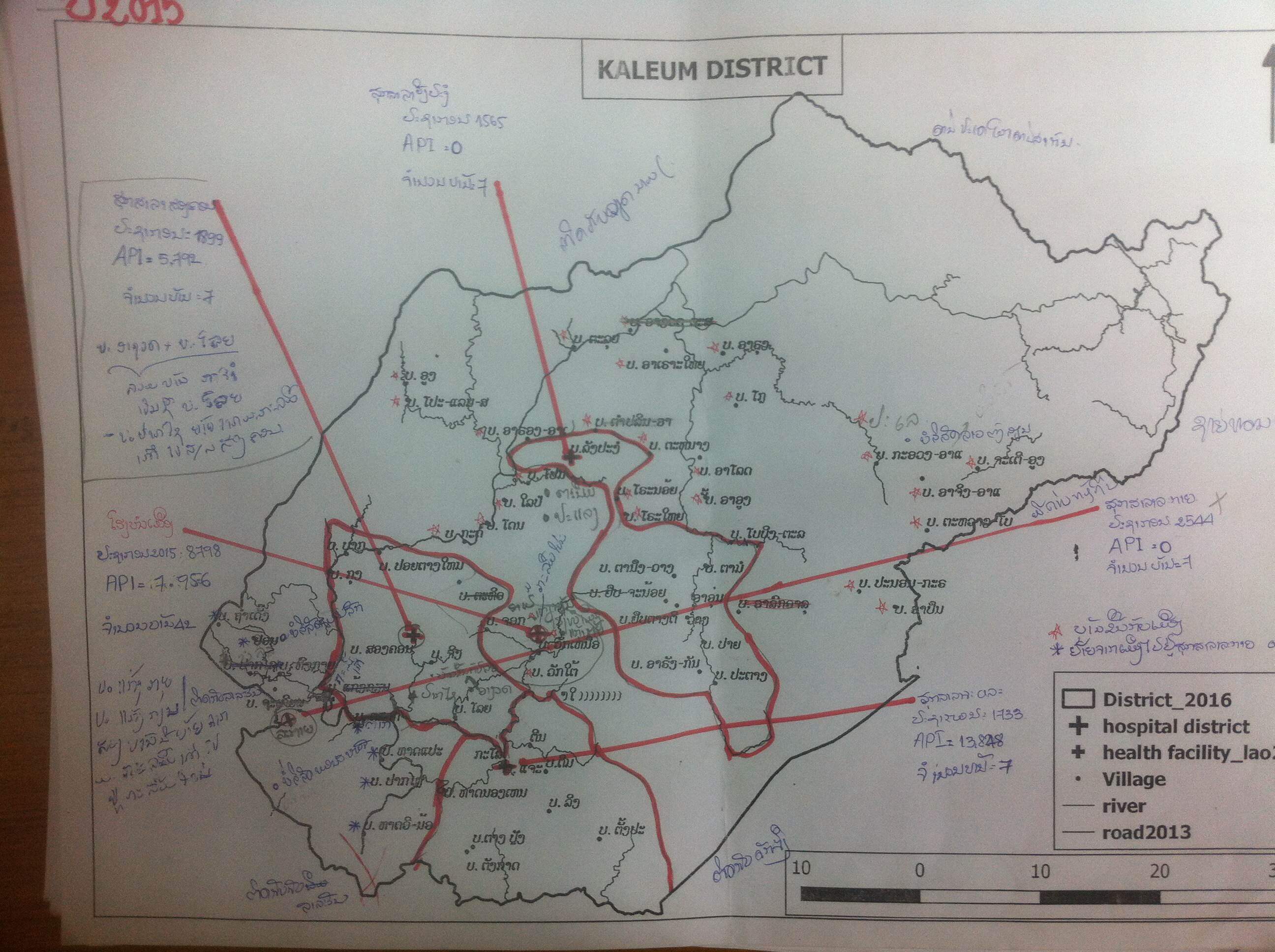
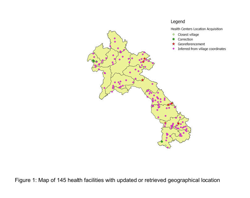
Description
Following a data collection exercise from November 2016 to January 2017, every districts in Laos have been surveyed and a map was produced with handwriting on it providing the location
and information on the Health Facility in the district. Those maps had to be processed to extract coordinates.
Technologies
QGIS, georeferencement
What did I do?
I worked on the printed maps to find the location of the villages and did some geo-referencement.
Period
February 2017
Description
Technologies
QGIS, georeferencement
What did I do ?
I worked on the printed maps to find the location of the villages and did some geo-referencement.
Period
February 2017
Screenshots
How can I help?
Whether you already know about your data pain points or just want to have a friendly conversation, send me a message.
