Description
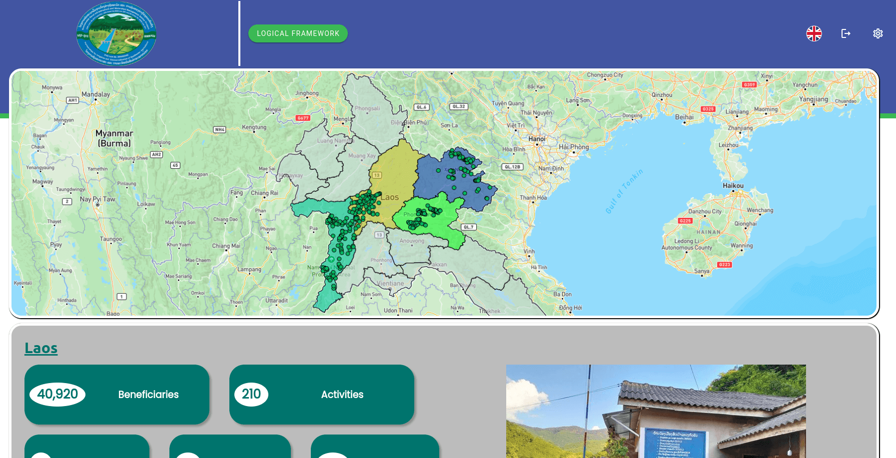
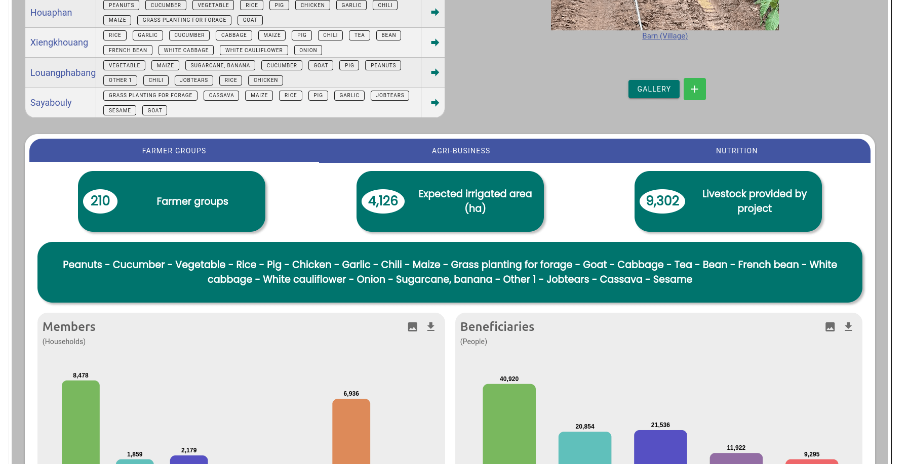
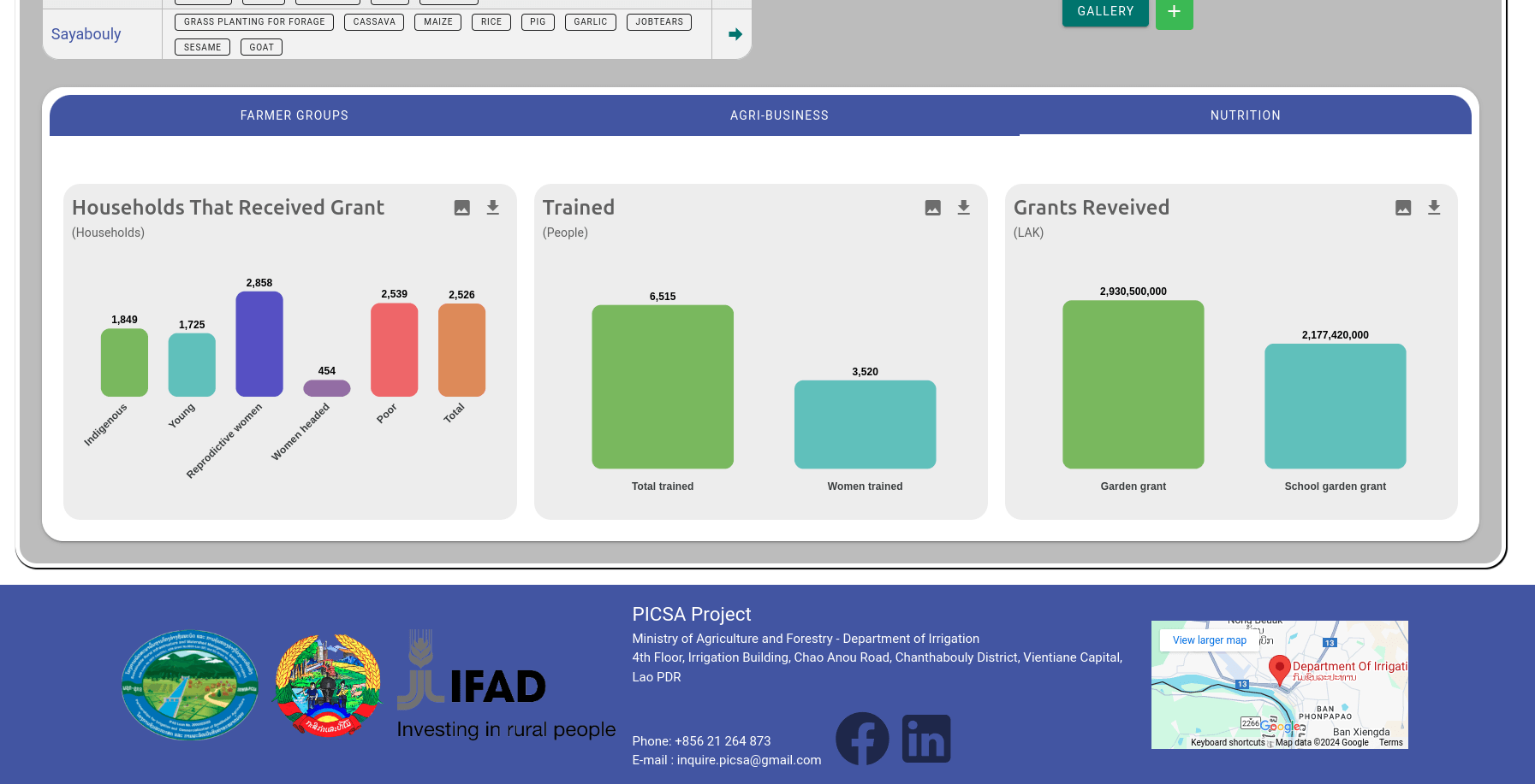
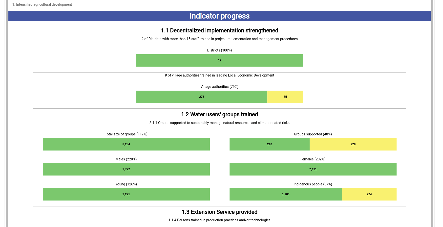
The system displays a map of Laos showing the villages benefiting from the PICSA fund for agriculture. Data and photos for each project are available for consultation, as well as aggregated data by district and province.
Technologies
VueJS, NodeJS
What did I do?
Complete system development, maintenance, training.
Period
2023-2026
How can I help?
Whether you already know about your data pain points or just want to have a friendly conversation, send me a message.
